Oregon is a very interesting and diverse state, from a landscape photographer’s point of view. All the way to the west, the rugged coast line hugs the Pacific Ocean, all of it protected by the state of Oregon for public use. Moving inland, the coastal range contains temperate forest with tall trees filled with thick mosses, just like a fairy tale wonderland. The other mountain range, the majestic Cascades, features snow-capped volcanoes stuffed with turquoise lakes and white rivers. The Willamette Valley, parallel to the coastal range and the Cascades, is as flat as the flatlands of the Midwest and remains frost-free year-round. Most of the rest of the state (which is ~2/3 of the state, by the way) contains high desserts. (brown and orange, mixed with some red) In the middle of this huge area, at the southeastern corner of Oregon, lie the Steen Mountains. The Steens is a flat, fault-block mountain that just stood out on its own in the middle of the dessert. Because the Steens is so high up in elevation, it is almost always surrounded by clouds, and itself is snow-covered almost year-round; these make it a stark contrast to the reddish brown dessert down below. Southeastern Oregon is a sparsely populated part of the state, and the Steens is even less populated, being extremely remote from civilization.
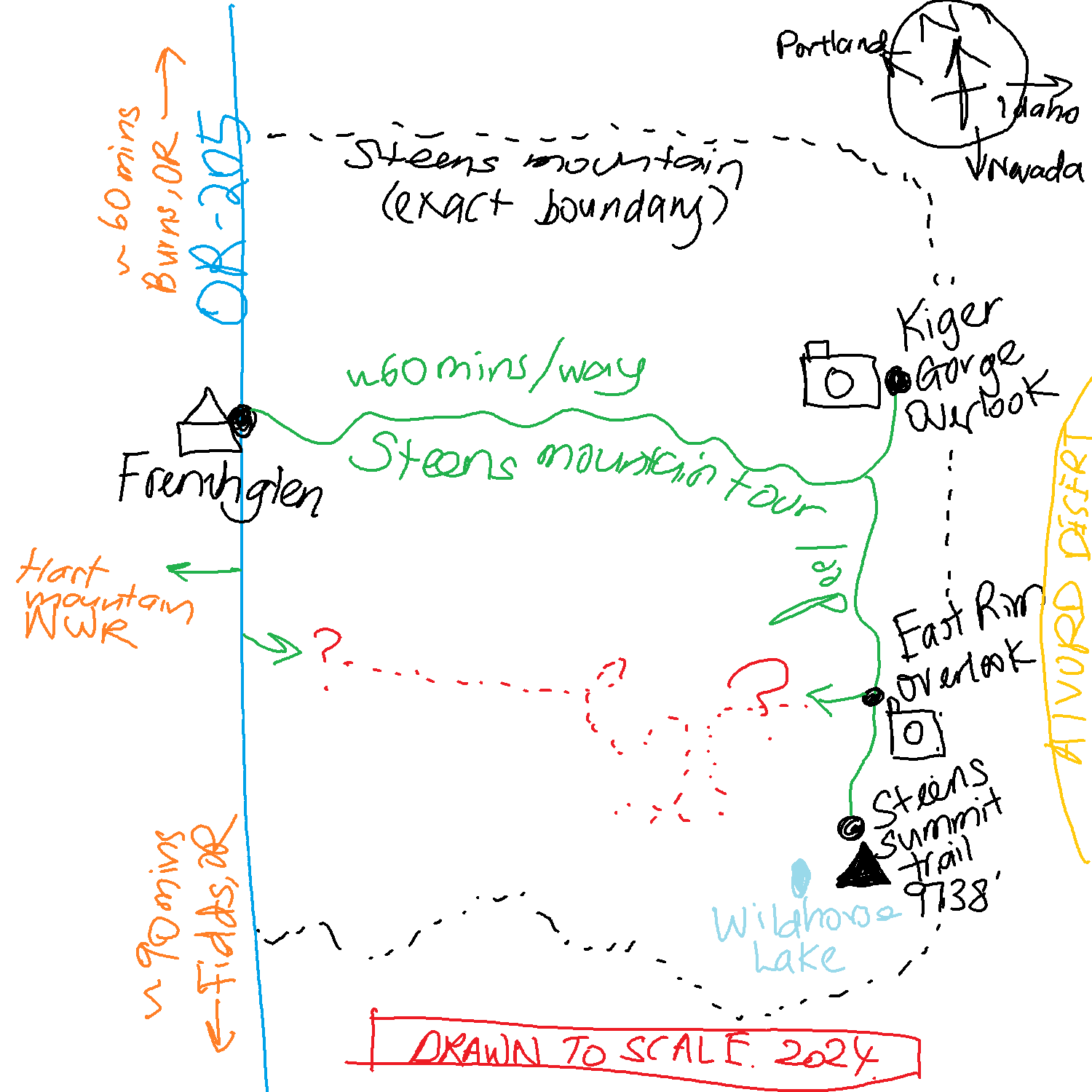
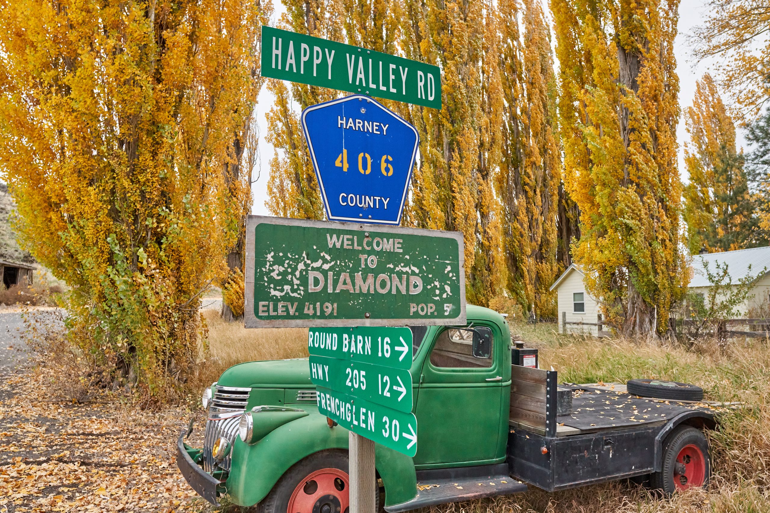
Eric and I drove up through the Steens a few years ago, but we did not realize that the Steens Loop Tour Route into the mountains were closed the majority of the year, and we had to settle by seeing the mountain from afar. Since then, Steens Mountain has been on my to-see list, and I’ve finally planned a second trip to this corner of the state. I plan to visit in late October for the fall colors, but I’ve forgotten to account for high elevation snowfall, and the roads tend to close by November 1st (after researching their Facebook posts over the last few years). Information tends to be sparse and repetitive and does not answer our fears. Basically, it was a gamble to plan a few days in the middle of nowhere, not knowing if we could drive into the mountains. Moreover, the Steens Loop Tour Route had a major landslide somewhere in the middle section, so it became an out-and-back road trip. Finally, some information suggested that a passenger car could make it, while others highly recommend high-clearance vehicles. Whatever, it was a go once I booked accommodation in Diamond, a tiny village close to Steens.
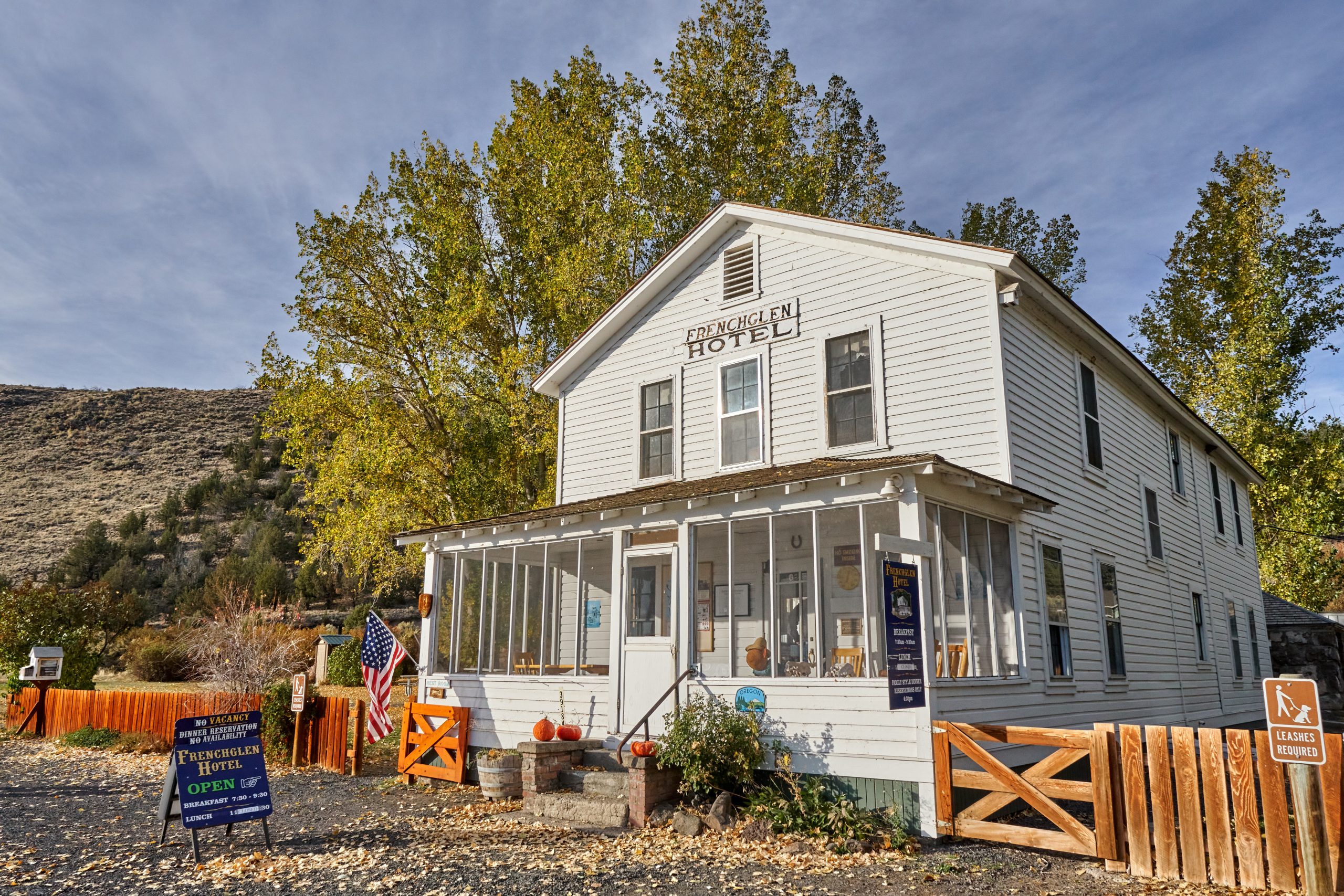
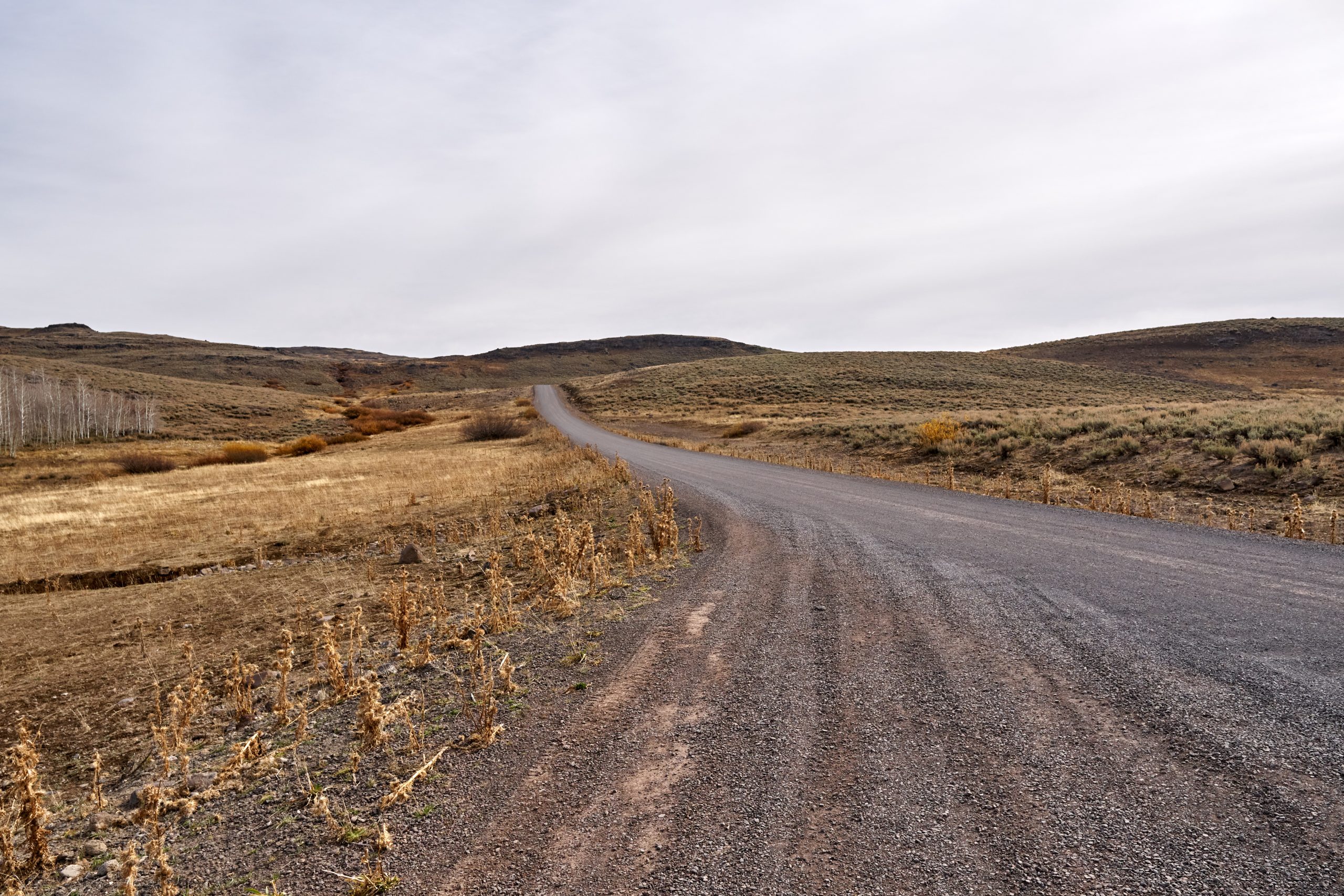
The bad news was that Steens received snow a week before we got there, and BLM (who oversees the area) was debating if they wanted to close the road. The good news was that it was so warm that we believe the road was ice-free, but again, no information on the road conditions was available, so we stuck to the plan and drove up the mountain. The tour route starts in the village of Frenchglen, as we topped our car with really expensive gas. Then, my Mazda 3 hits the gravel road. The road might not be the worst gravel road we have driven, but that doesn’t mean that it is a great ride. More good news: we might be bumping non-stop for the next 30 miles, but at least this section of the road was not dangerous. The road climbs non-stop (gaining at least 5000 feet of elevation), but it feels like we are just driving up a very flat plain with few trees and man-made structures to obstruct the views along the way. I couldn’t even believe we were at 8000 feet when we got to the first view point, Kiger Gorge Overlook, because it had been a very flat drive the last hour.
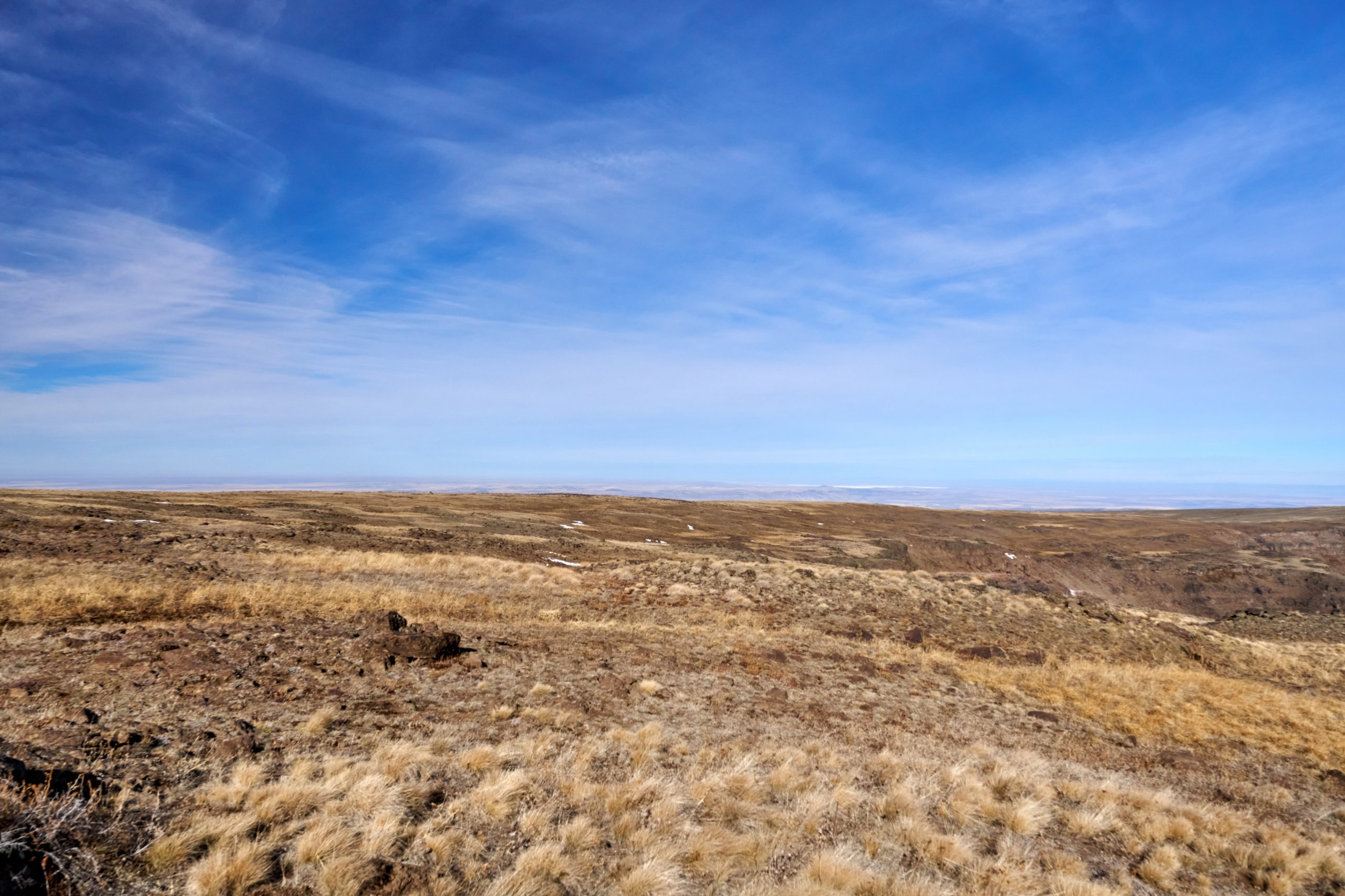
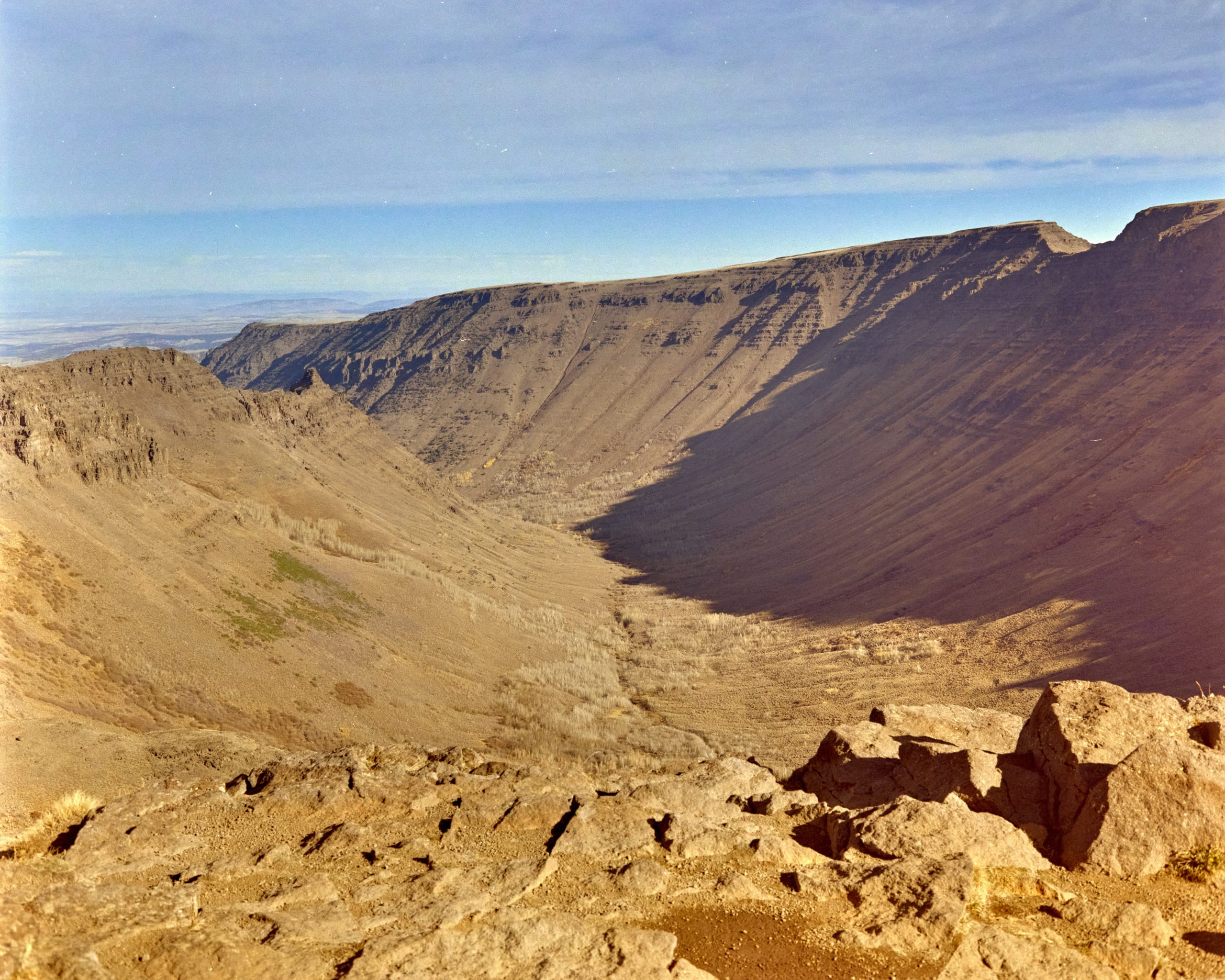
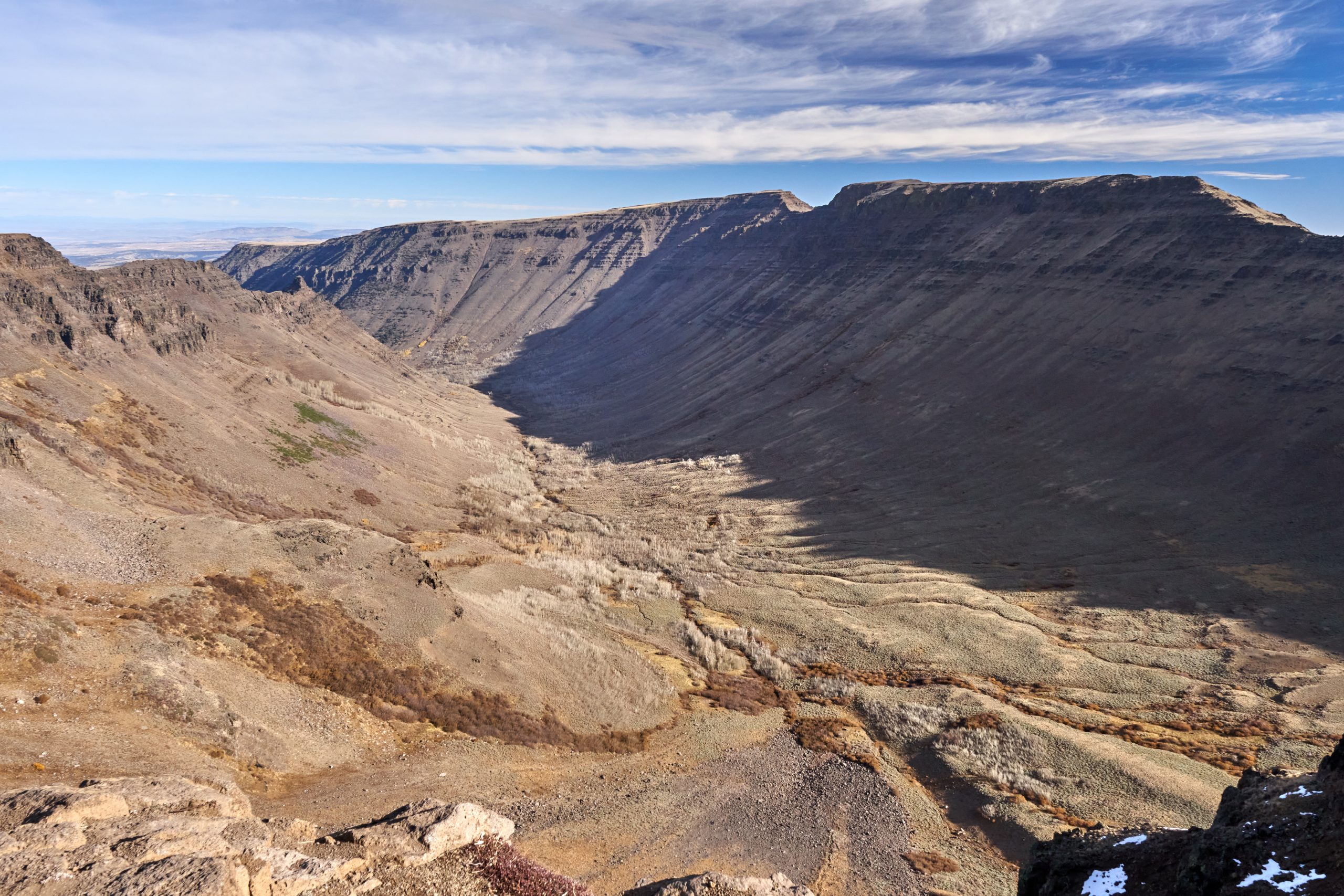
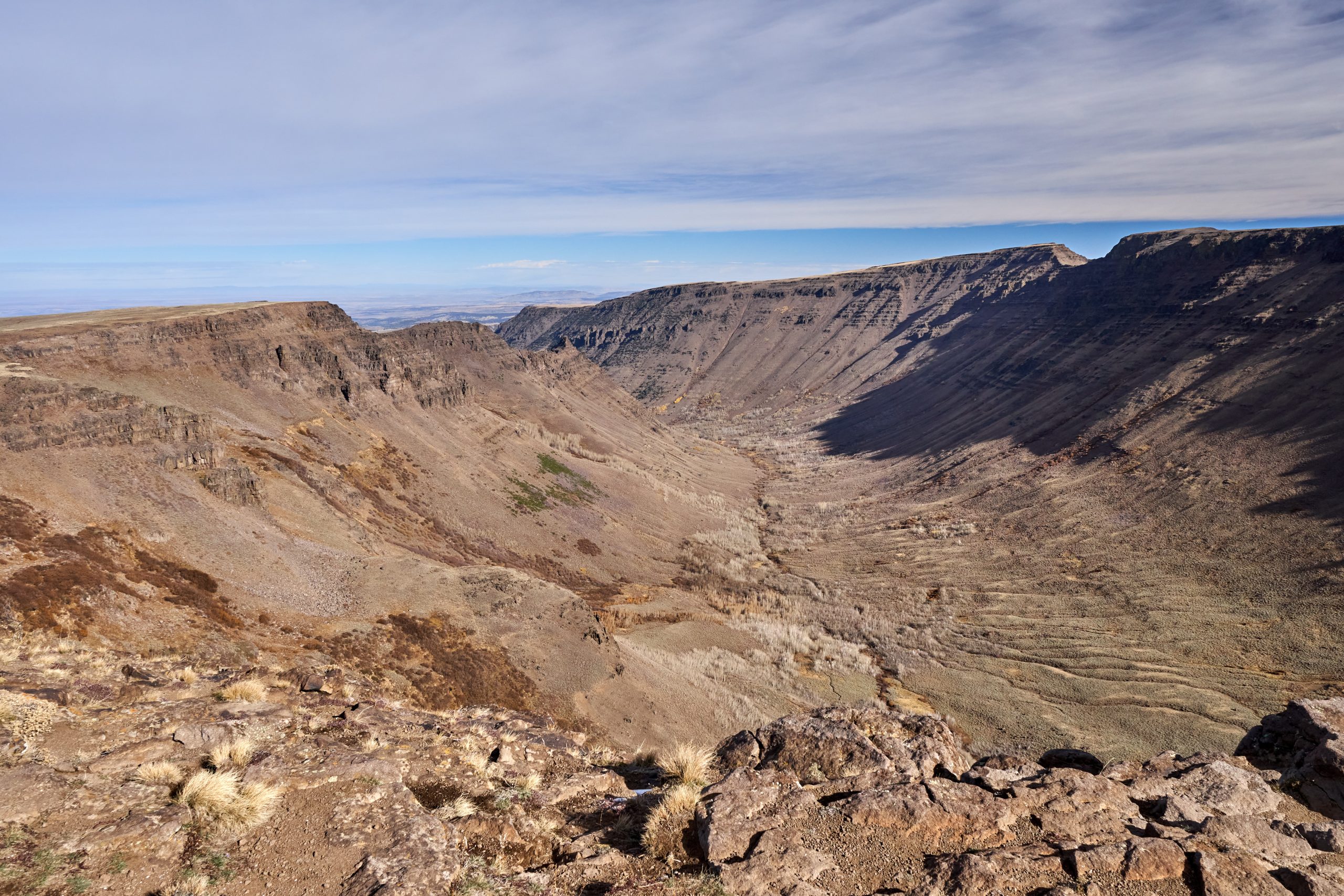
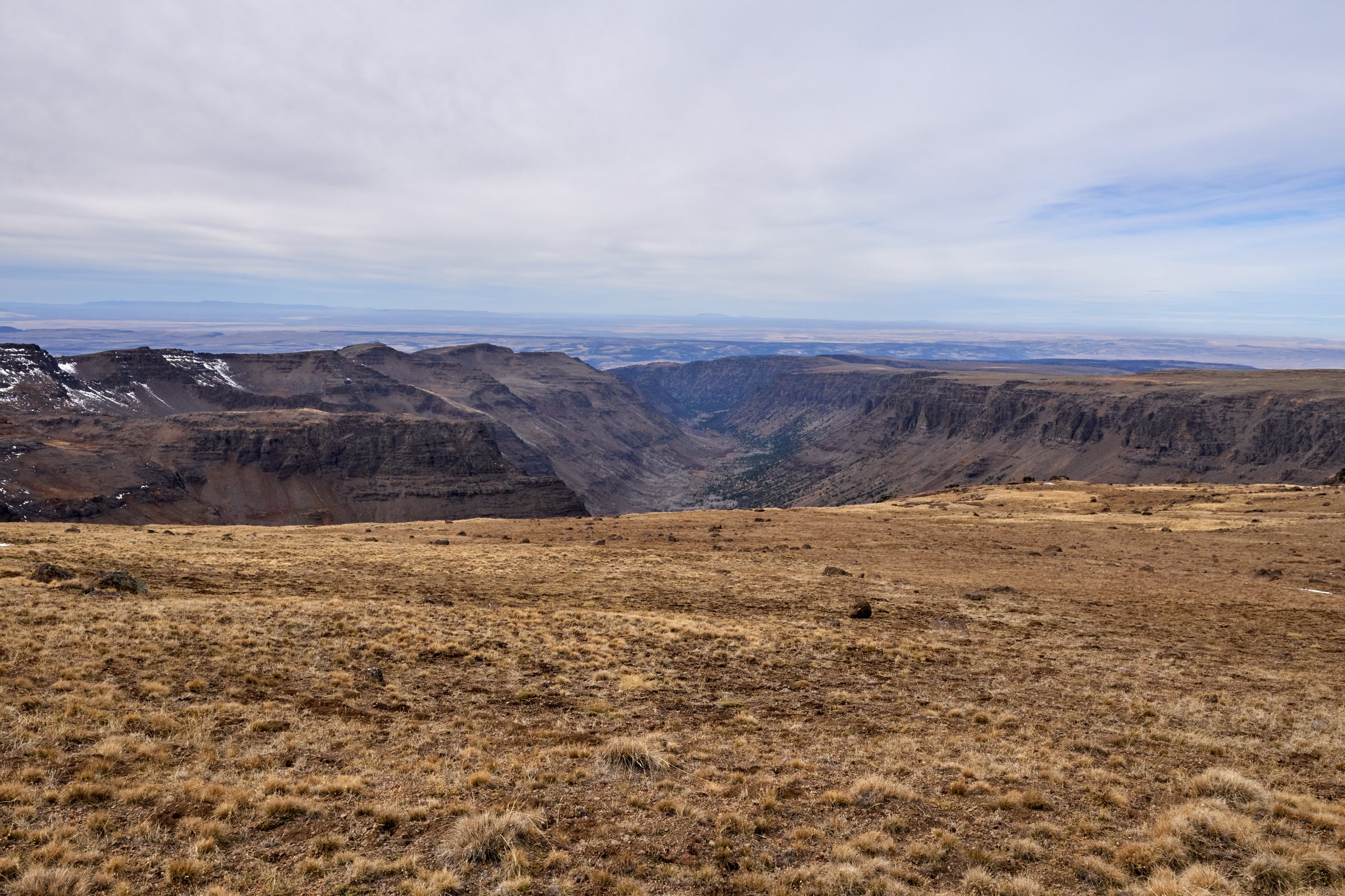
Kiger Gorge was stunning. The parking lot got us to the cliff of a U-shaped valley, carved eons ago by miles of glacier. The slow and heavy glacier, filled with rough gravels and boulders, destroys the mountains by carving steep canyons along its path. As a result, a “U”-shaped valley is formed, unlike a V-shaped valley carved by a river. Glacier-carved canyons such as Kiger Gorge are spectacular, as there is a huge drop from where we are standing down to the bottom of the gorge. We could see the other cliff in the distance, but there is no way to get there unless we hike around a very narrow ridge or go all the way down to come back up again. We got a close-up look at the signature “gunshot” chip off the cliff, which is huge. It might be snow-free here, but the strong wind gusted non-stop. The best of all, it was deserted. We saw two more cars but did not know where the people went.
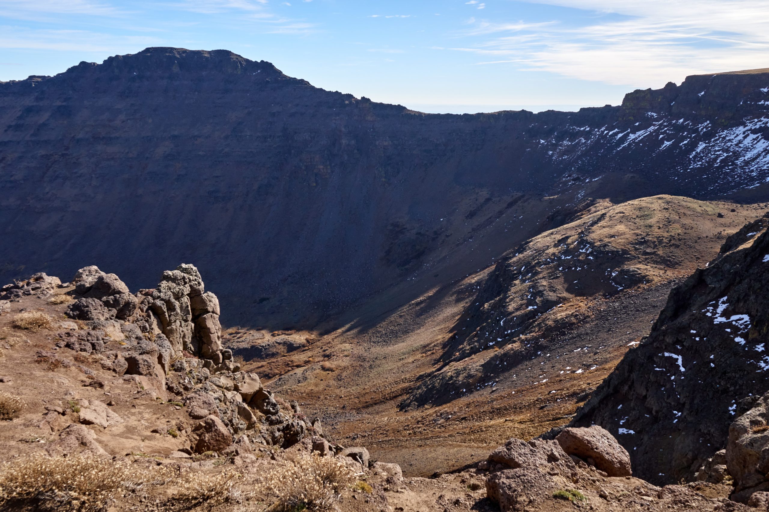
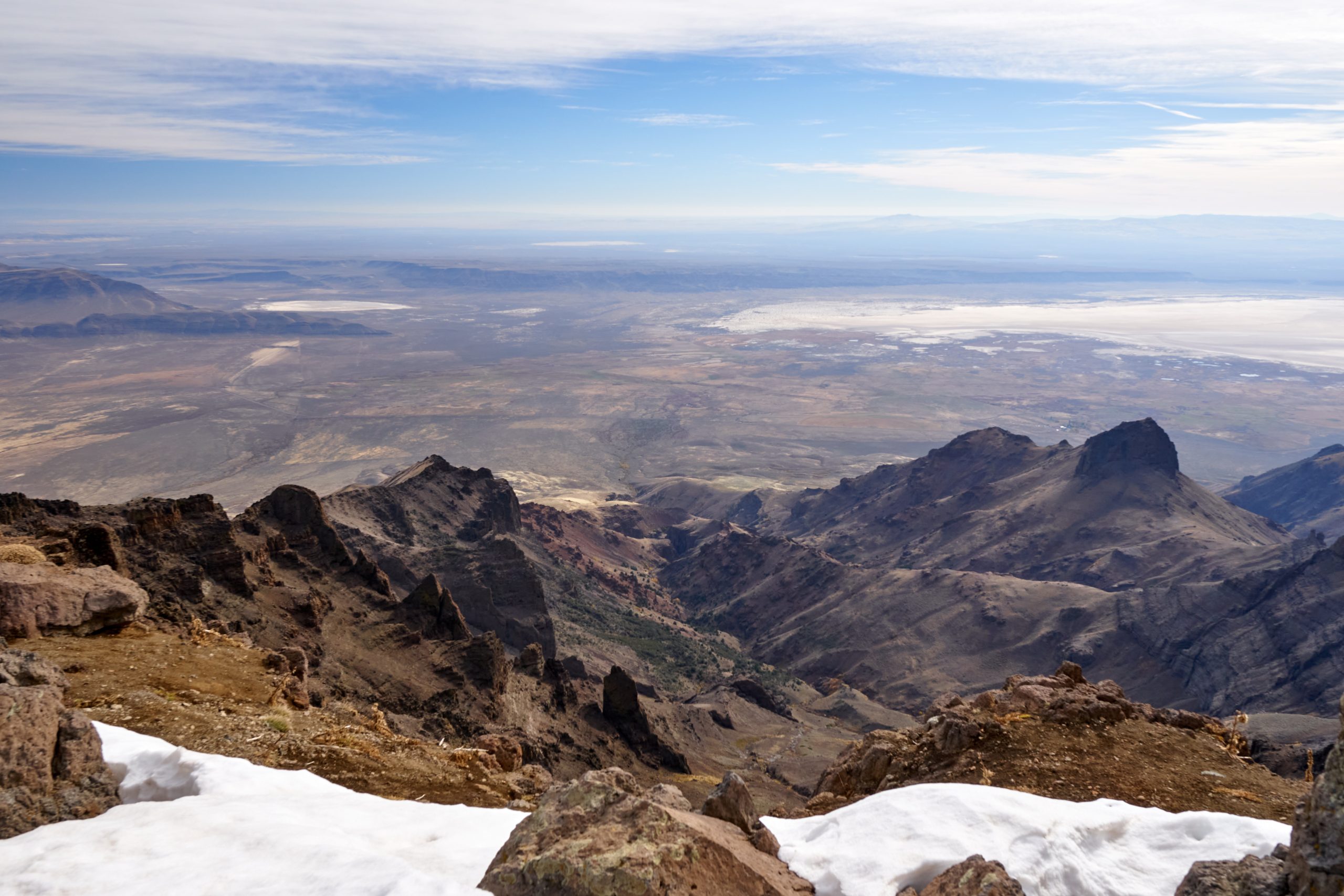
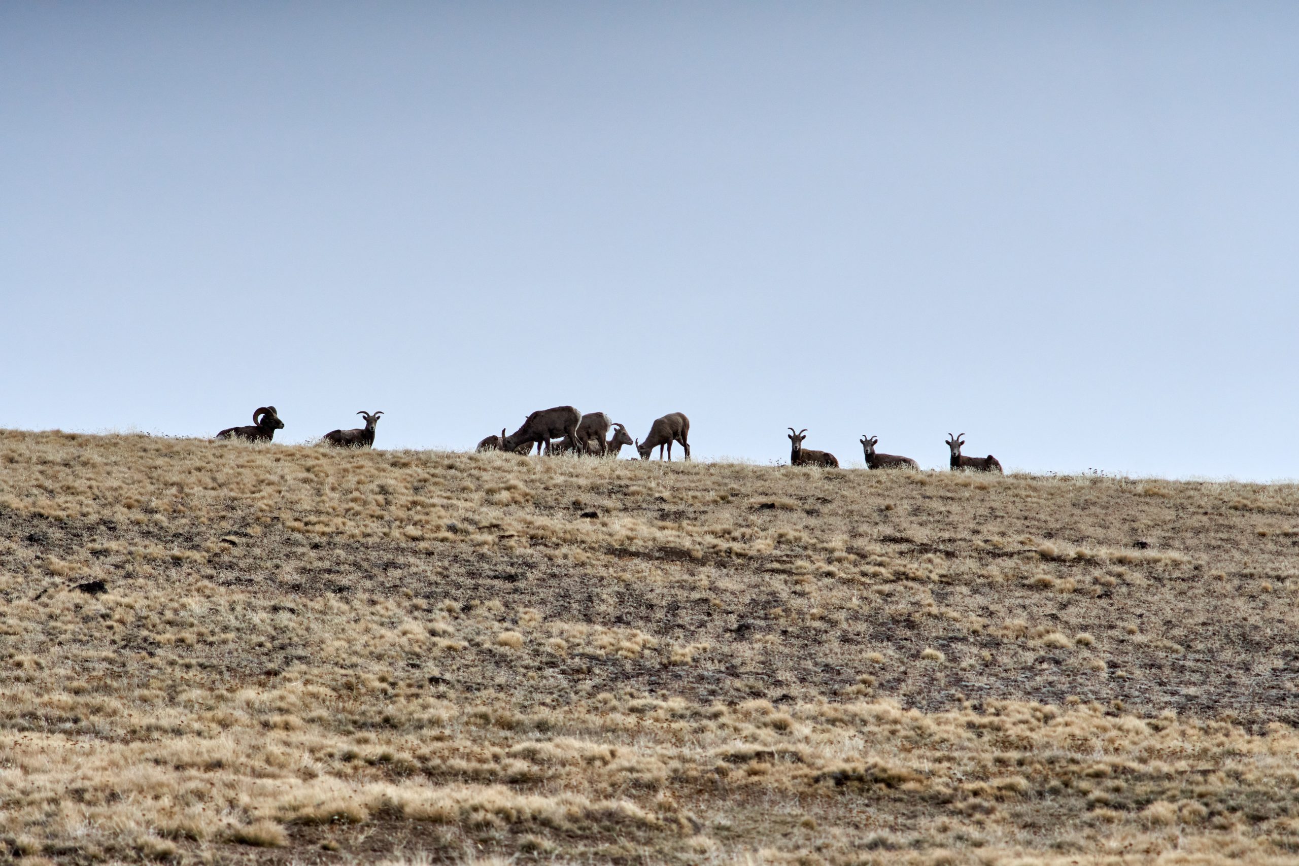
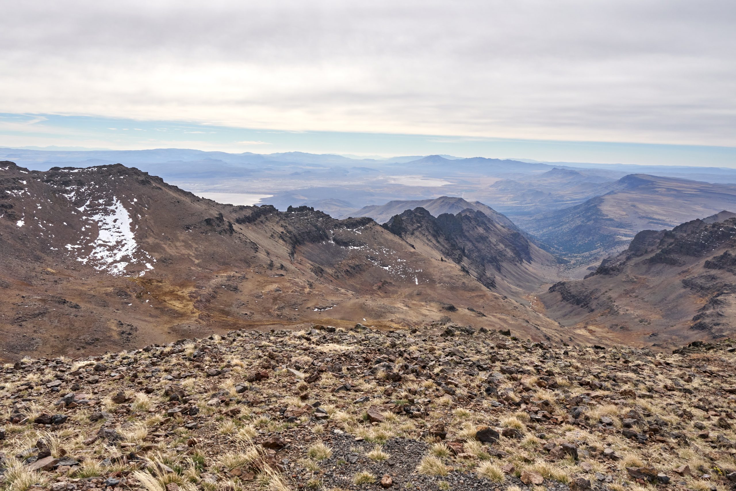
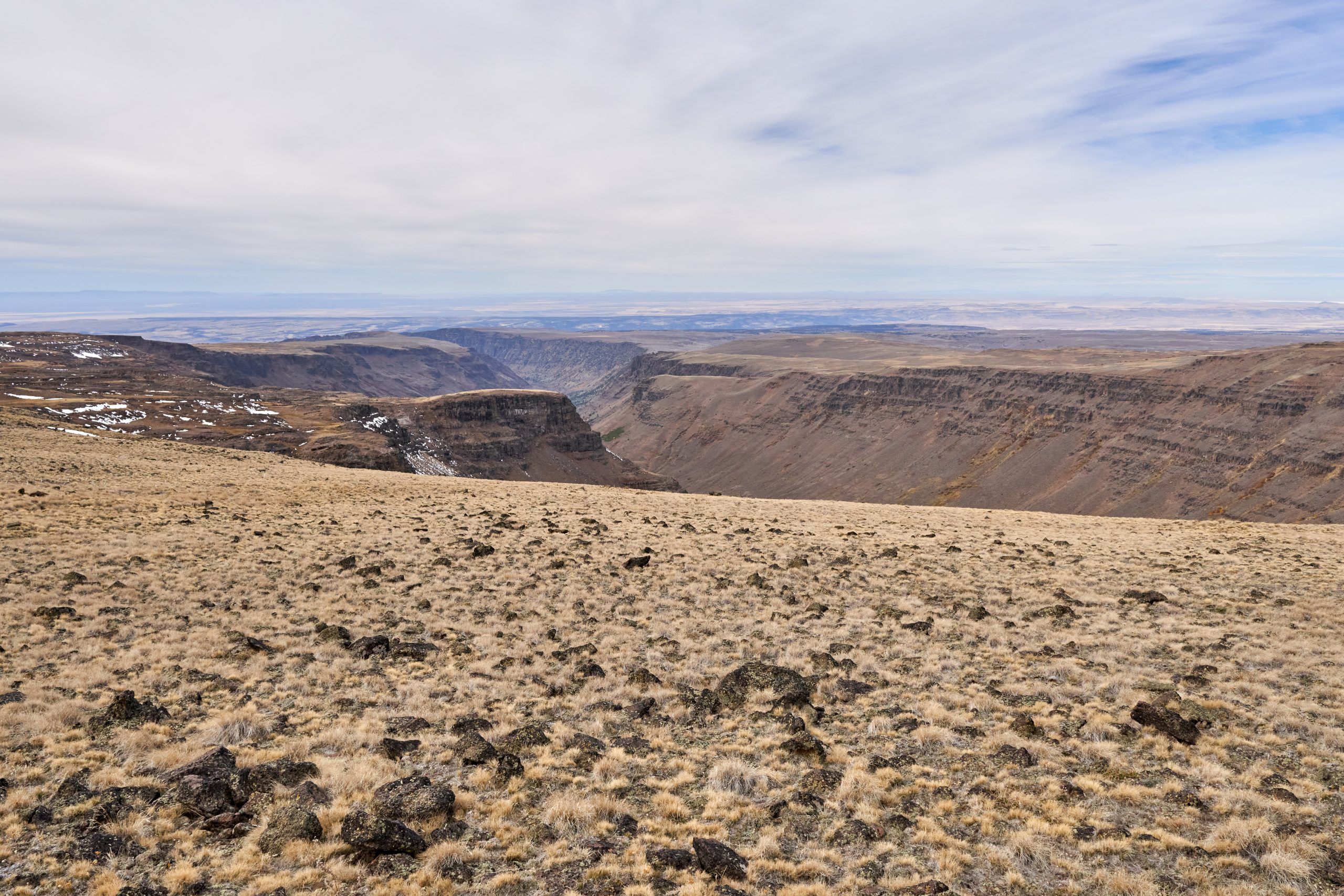
The next stop was at the East Rim Overlook, a few miles south of Kiger. The road remains bumpy, and we did not see anyone here. East Rim is directly over the Alvord Dessert, an extremely flat playa that extends for miles. There are also not many geological features east and south of here, so it feels like we are standing at the end of the world, looking into nothingness into the infinite distance. (Even though we know that Idaho and Nevada are supposed to be over there.) There are much fewer things to do here; there is not much of a trail unless we want to walk along the ridge. We did spot a herd of big-horn sheep around the area. It is kind of odd that they are still in the mountains as the weather is getting cold, but maybe they are just like us, trying to get one last bite before descending into the valleys.
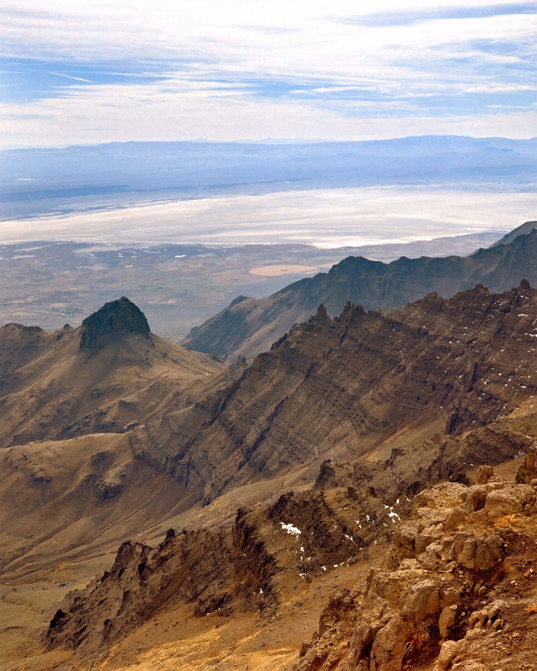
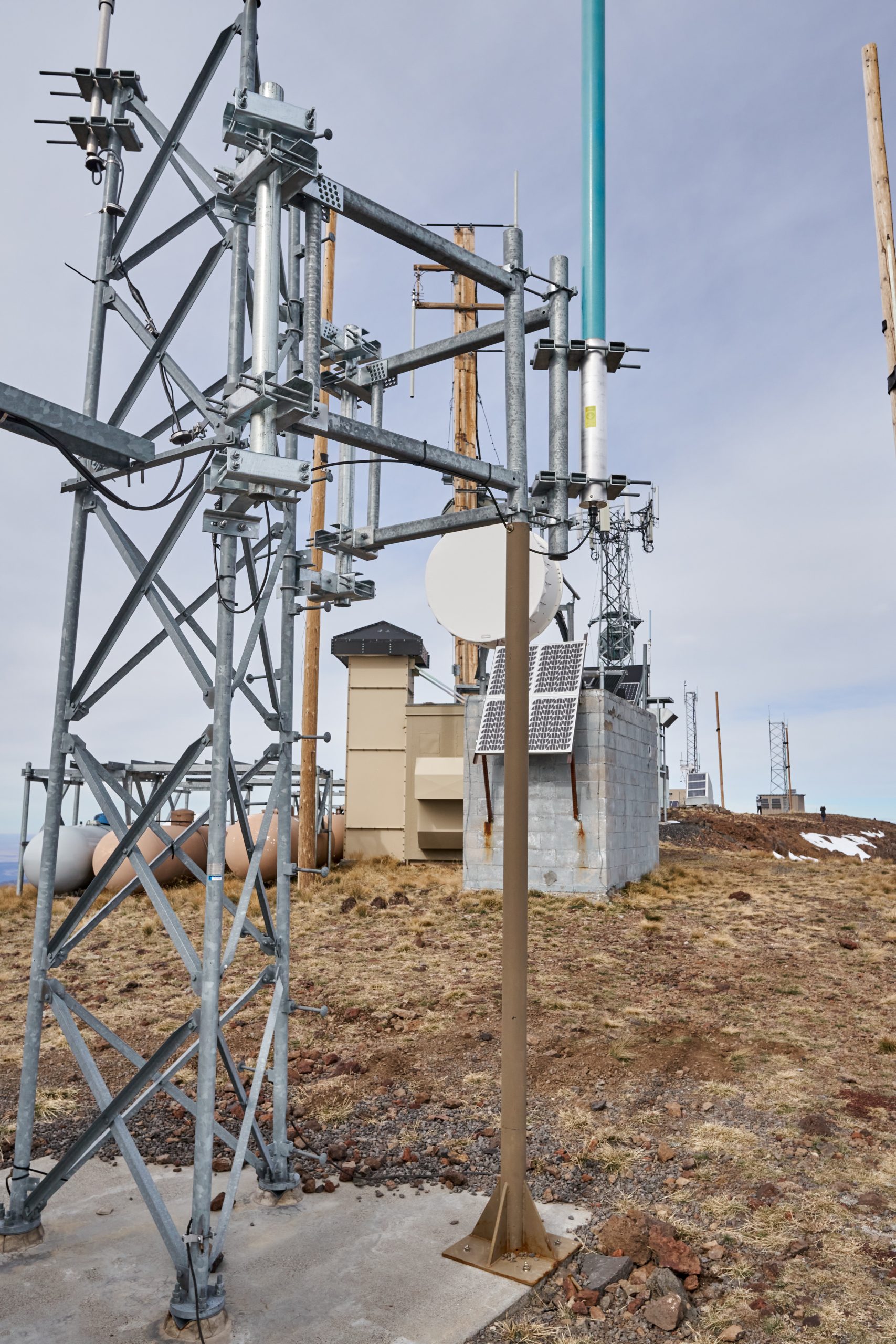
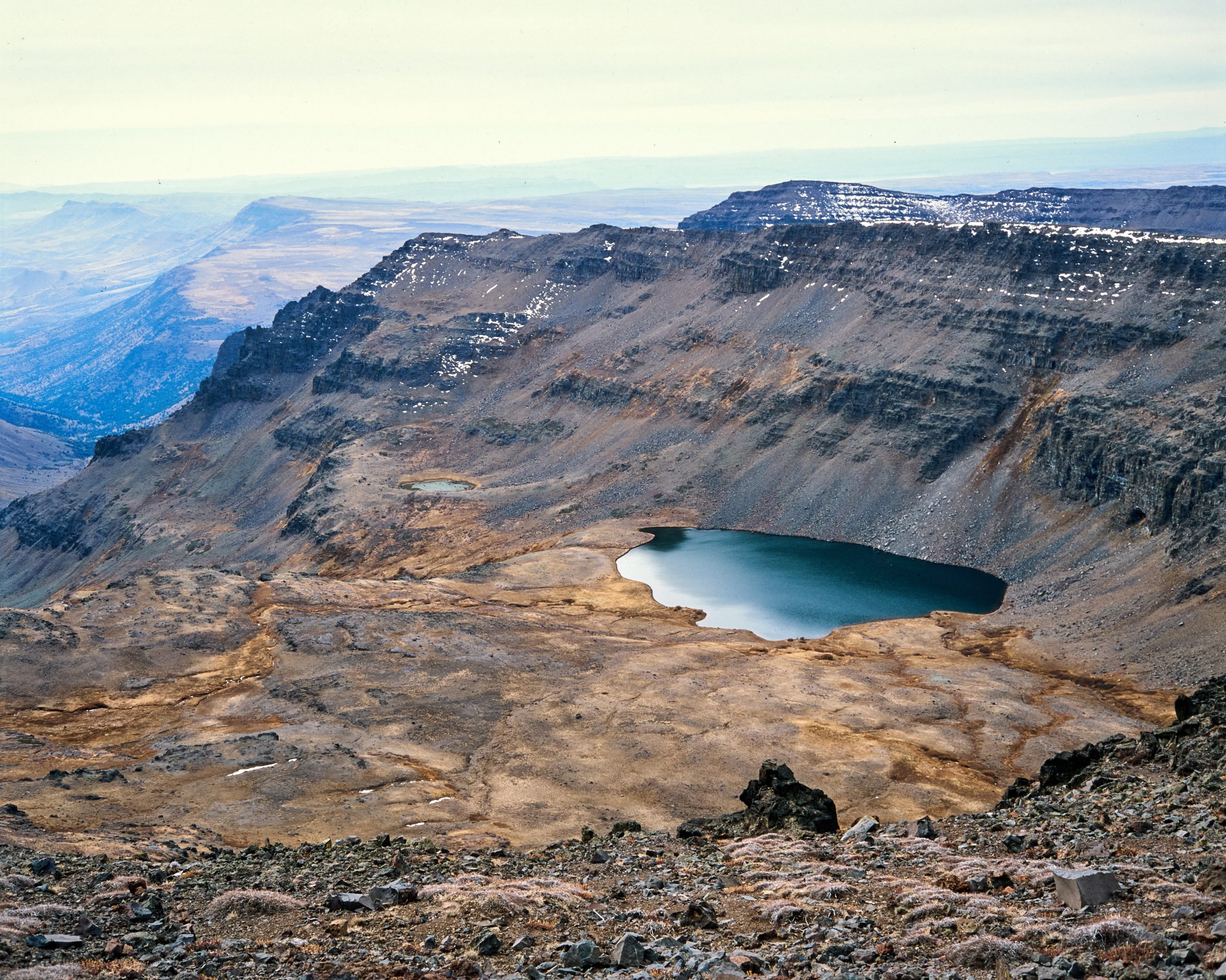
The last stop is further south, basically at the end of the road. The parking lot doesn’t provide a great view because we are blocked by the Steens Mountain peak itself. At 9700 ft, this marks the highest elevation of a road in the state of Oregon, which wasn’t that difficult to get to. We got a quick lunch in the car, as the wind is howling outside and bombarding everything with some hail too. Then, it was a short hike to the peak. Down in another gorge lies Wildhorse Lake, which we would have normally hiked down on the trail, but definitely not in this wintery condition, especially at such high altitude. It does look gorgeous. The trail we are on is a road that researchers use; yes, there is a huge research facility, probably owned by the USGS, to study the mountain and collect data. Most of the buildings are not fenced, but all are secured and functionally supported by countless solar panels and generators. It would be cool to have a website to see what they do; all we got was a warning to passersby about the high amount of RF. WE SHOULD BE GOOD. Anyway, the view here is similar to the East Rim Overlook, but instead of a steep cliff, we get a more gentle slope towards the south and the east, and thus a less dramatic view. With that said, we are now at the highest point in at least a 200-mile radius, probably more. Pretty dang cool.

Plaubel Makina 67 | Nikkor 80/2.8 | Fujifilm Provia 100F
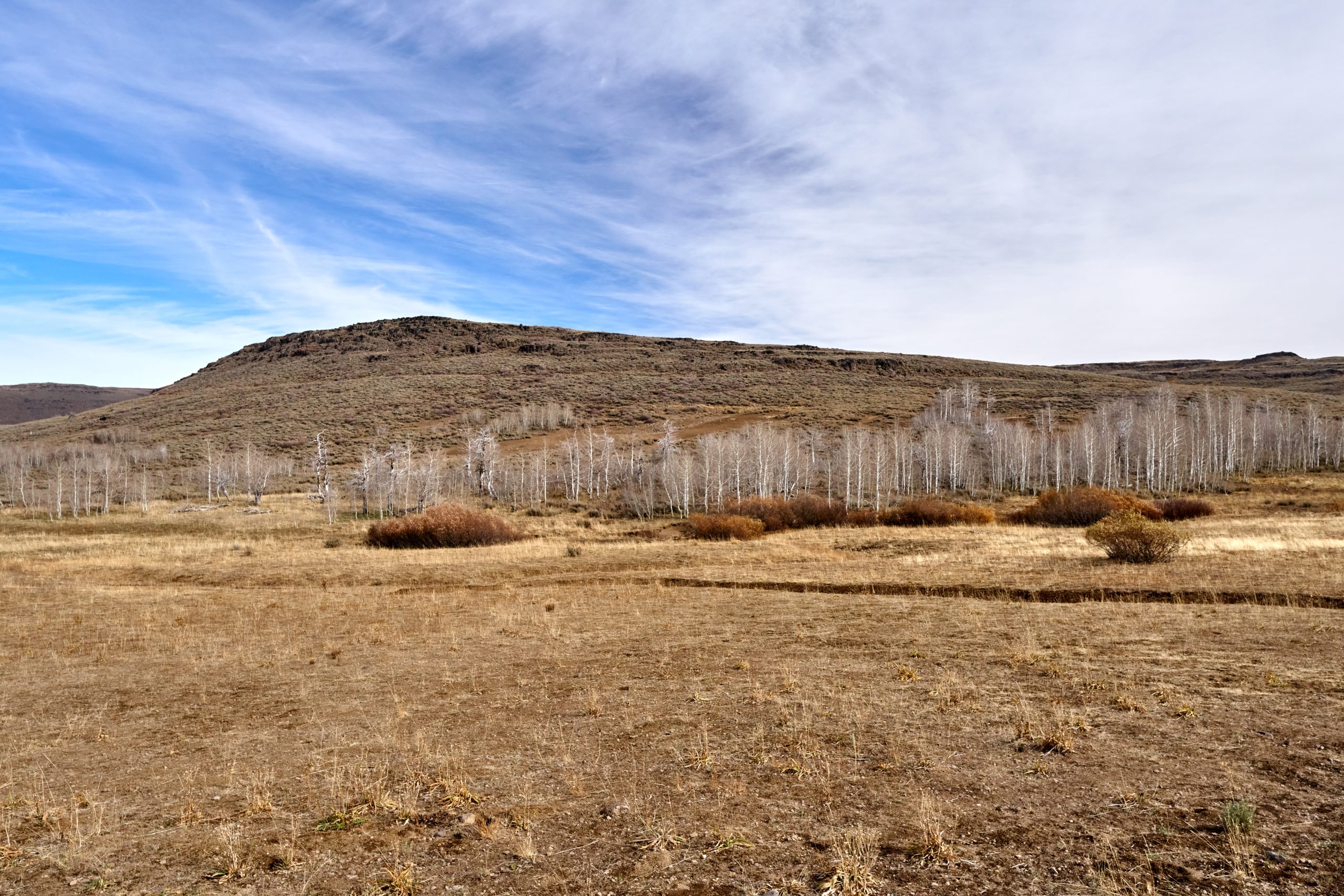
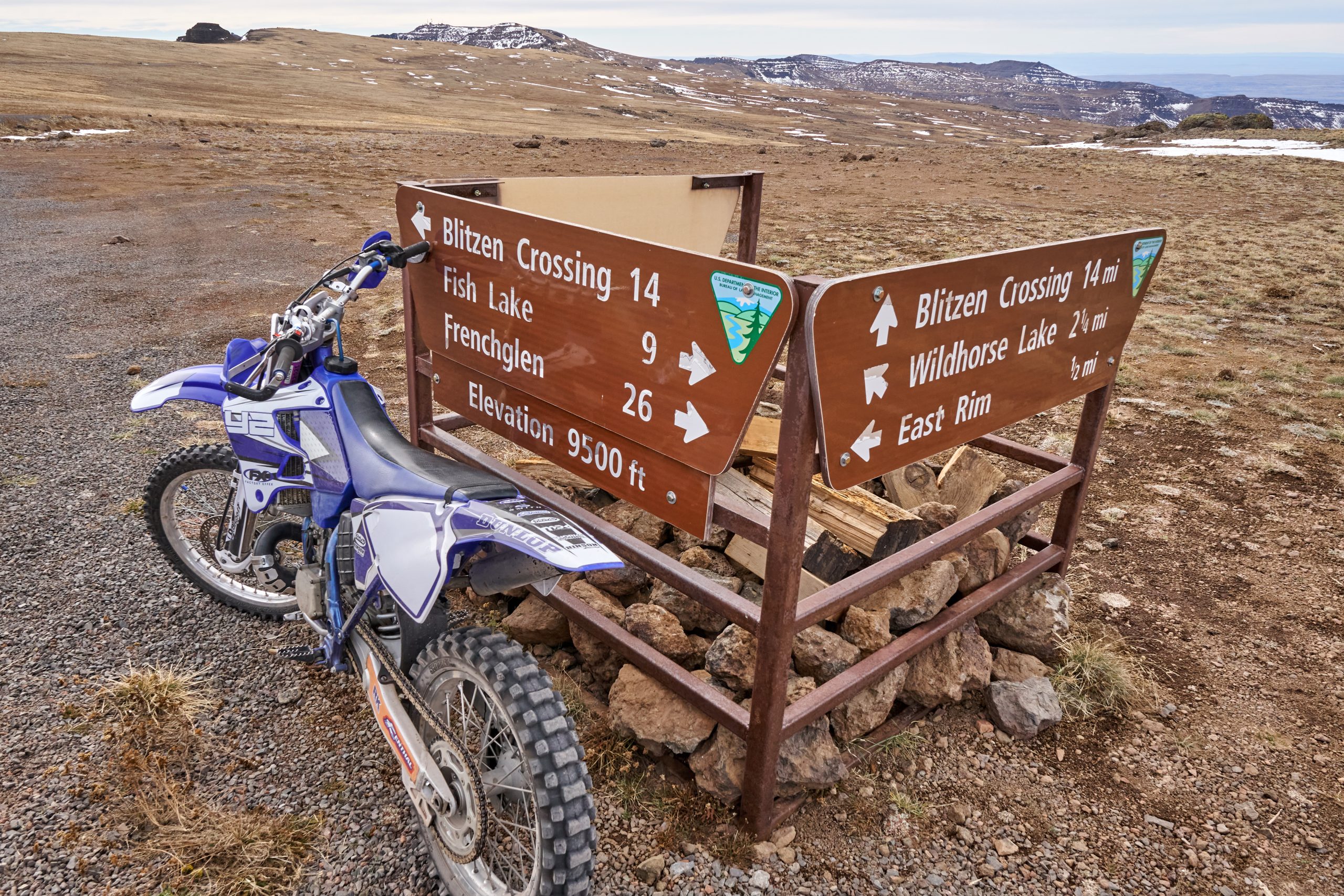
On our way back, we stopped at a few signs along the road. There are some longer-distance trails in the Steens, but information is extremely hard to come by. There is a makeshift sign at the major junction for the roads, and two more signs point at Indian Creek and Little Blitzen. The two viewpoints were impressive, at both U-shape gorges, but because this is on the flatter side of the mountain, they felt very far away. Otherwise, it took another hour to get back to Frenchglen before the Mazda 3 could speed on pavement again. To complete the tour loop, we would have to drive up from the other end, but I’ve also read that that section contains a narrow, windy path. Maybe that’s the part where a high-clearance vehicle is recommended. We did miss two more overlooks and a day hike at the historical Riddle Brothers Ranch, but we were satisfied with what we saw. It’s definitely one of the more impressive locations I’ve been to, with spectacular vistas on top of an oddly flat fault-block mountain. However, the two-hour bumpy road ride (and another two-hour round-trip to the nearest town), the lack of a loop, and the lack of many short hiking opportunities make it hard to recommend it as a destination unless you are coming here as part of a larger tour of the surrounding areas. We also came slightly too late; the aspens in lower elevation would have been in peak color if we had come a week or two earlier. But with life, we get what we are given, and I’m glad to check this place off.
***** Bo’s Best of the Best.
Issue 88. Volume 14. Chapter 7.
Date: October 24th 2024, Tuesday.
Website: https://www.blm.gov/programs/recreation/recreation-activities/oregon-washington/steens-mountain